Friday, November 25, 2011

Bridge of the Week #73: Saw Mill Creek Bridge


This week's bridge is again on Staten Island - the Saw Mill Creek Bridge. This steel and concrete bridge carries Chelsea Road over the Saw Mill Creek in the Bloomfield area of Staten Island, an area south of the Goethals Bridge, west of the West Shore Expressway, where there are inlets and wetlands off Arthur Kill, the waterway between Staten Island and New Jersey. There are some industrial areas there and a few other businesses, but not much for residences nearby.


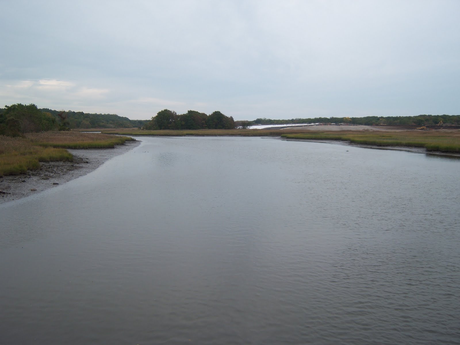
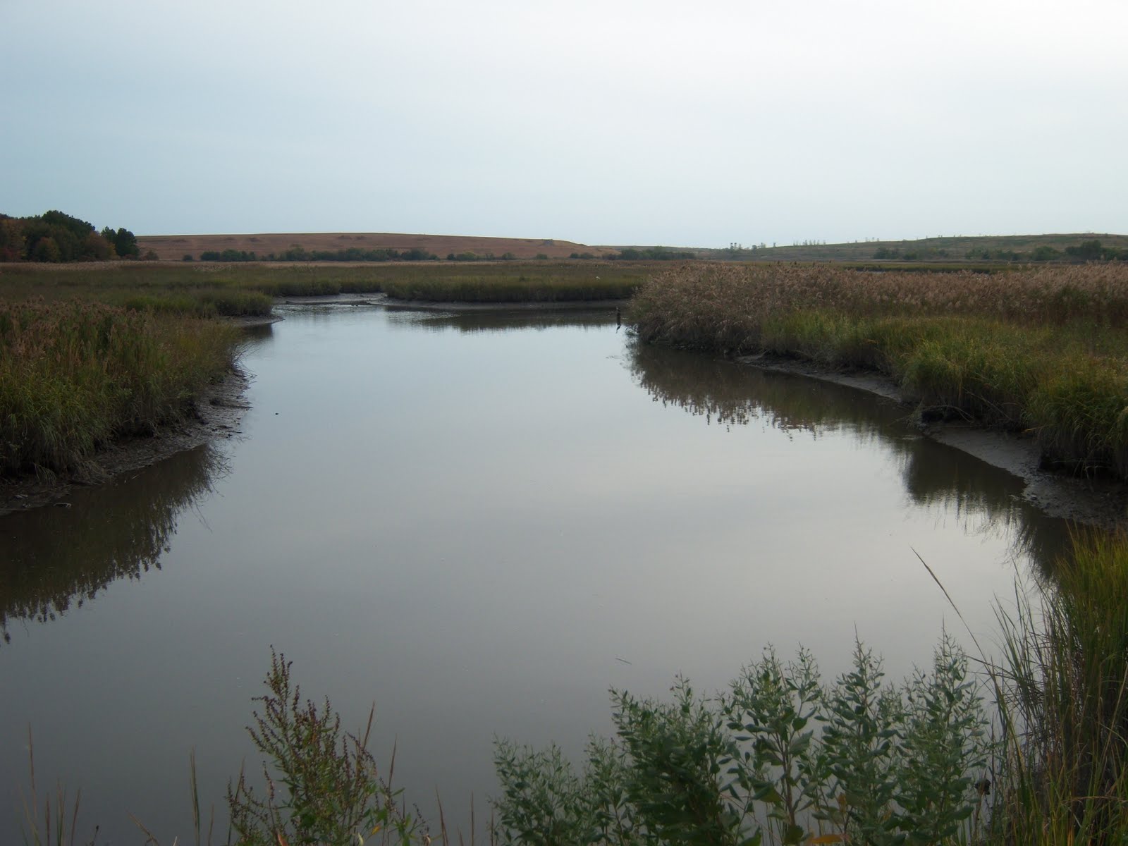
I don't have any stats on the bridge, the first picture above pretty much tells the story of its size. (The second picture is the view west from the bridge.) There are sidewalks on the bridge, but no sidewalks on Chelsea Road leading to and from the bridge. But when I ran it, there was little traffic on the road. While there actually can be some appeal to running on these low-traffic remote roads, I wouldn't think a lot of runners from other parts of the city or the borough would have much interest in taking the bus all the way out here for their run. Unless they happen to want to run all the bridges of the city.

Sunday, November 20, 2011

Race Report: JFK 50 Mile


After years of being told I have to run JFK, the largest ultra in the country with over 1,000 finishers and possibly the oldest continuous existing ultra, I had signed up for the 2011 race. This race started out from a comment by Theodore Roosevelt that all military personnel should be able to cover 50 miles on foot in 20 hours. The first race was held in 1963 under Kennedy's administration.


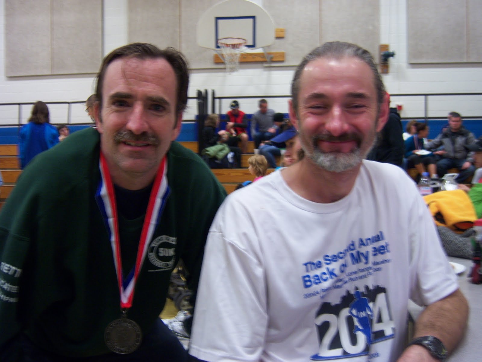
I rode down to the host hotel in Hagerstown, Maryland with long Island runners George Worth, Jim Morris and Tim Henderson (first pic above). We received some shocking news at the pre-race briefing by race director Mike Spinnler, that the administrator of the Appalachian Trail, Pamela Underhill, not only refused a permit for an additional 500 runners but stated that no permit would be given for the Appalachian Trail after 2012, saying "the runners won't mind not using the Appalachian Trail"!!! What's up with officials refusing or rescinding permits for ultras (as in Morris County, NJ)?!?! Mike is hoping to get a Congressional resolution passed to allow continued use of the trail for six hours one day a year for future races. Please check back with the JFK 50 web site for details and updates.


But back to the race. I hadn't run this race before, and I haven't run any 50-mile race in quite a while, so I really had no idea how I would do. Only the first 15.5 miles is on hilly, tough trails, so I was estimating something between 6:30 (on the very optimistic side) and 7:00. I wasn't planning to worry too much about competition, just to get on the trails, which I don't do too often, step outside my comfort zone a bit and enjoy one of the most celebrated ultras in the country with the richest tradition.


I'm guessing that most people reading this have either run the race or know people who have, so I won't bother with a course description. The weather was good, cold at the start in Boonsboro at 31 degrees, but a forecast high near 50. Once we got on the Appalachian Trail, I understood what everyone meant when they warned me about the rocky trail. Most of it was fine and with some careful foot placement was very runnable, but a few sections were really tricky and tough to maneuver. Still, I was happy with my pace on the trails as I descended the switchbacks on my way to the to the towpath.


And once on the smooth, flat towpath I tried to get into a good road-type pace, hoping to pass some of the runners ahead. It was hard for me at this point to judge my pace, but there were mile markers on the side of the path, so when I did check my pace, I was happy to see it near 7:00 per mile. The scenery along the Potomac was beautiful to be sure, but I was getting a little chilled when the path went into the shade. But it was similar scenery the entire 26-mile length, and after roughly the 30-mile point I wasn't seeing any other runners, so it was getting a little lonely and it was tough to feel like I was making forward progress. The aid stations helped a lot with both of those issues, and they were tended by an amazing bunch of volunteers. So I was counting down the miles on the towpath, even as I did slow down a little the last several miles.


After about a 3:20 marathon on the towpath I finally turned onto the road for the last 8.5 miles, and I felt like I was home, being on pavement again! I was able to pick up the pace a little bit, and I saw a runner a couple hundred yards ahead of me, and I had hopes of catching him. Starting at eight miles to go, mile markers were place alongside the road, allowing me to really feel good about getting near the finish. Still, I was never able to get any closer to the runner in front of me, but I wasn't too concerned with that. Coming off the towpath, I looked to be well on track for a sub-seven hour finish, hopefully under 6:50. But as I neared the finish, I pushed a little more and was looking to take a few minutes off that as well. At this point I have to thank my friend Mike Oliva, an outstanding runner himself, who finished JFK in 2010 in 17th place with a time of 6:44 and I didn't remember how many seconds, because his time became my goal near the finish! The last mile seemed to take forever, but I finally finished in 6:44:24. It ended up being 19 seconds faster than Mike's time, so I do have bragging rights, at least for the time being!


So finishing at the school in Williamsport, the runners had massages, medical help, food and showers, and a lot of opportunities to meet and greet and swap stories, which really is the reward for all the work and pain we put ourselves through!


David Riddle won the race with a new course record time, unfathomable, of 5:40:45. Michael Wardian, continuing his amazing year (not to mention his career) finished a close second, also under the old course record, with 5:43:24. Cassie Scallon won the women's race in 6:31:22 and Meghan Arboghast, at age 50, got second with 6:35:16! Fellow New Yorker and past runner-up Mike Arnstein got 5th place. I was happy to see I just cracked the top 20, getting 20th overall, 18th male, and I was especially pleased to see I was 2nd male master, after Jon Lawlor, who finished 7th. My travel companions George, Tim and Jim all finished in excellent times, George taking an hour off his 2010 time. Many other friends ran and finished as well, too many to mention, but a big congratulations to all who ran! A big thanks to Mike Spinnler and all the staff and volunteers, and of course also to Tim Henderson, Jim Morris and George Worth for letting me tag along with them. And as always, a big thanks to my physical therapist, Dr. Jack Mantione, for helping me get the most out of this old body, and without injury.


Pics (sorry there aren't more): 1. Me, George, Jim and Tim back in NY at the GWB Bus Station; 2. Me and Serge Arbona after the race.

Friday, November 11, 2011

Bridge of the Week #72: Richmond Ave. Bridge


We're back to Staten Island for this week's bridge, the Richmond Ave. Bridge. It carries Richmond Ave. over Richmond Creek, between Forest Hill Road and Arthur Kill Road.


Richmond Ave. here is a busy stretch of six-lane road about a mile south of the Staten Island Mall and just north of the north end of the Korean War Veterans Memorial Parkway (formerly Richmond Parkway). The street runs north-south, and there is a sidewalk on the east side, which appears to get little use. (There is also a sidewalk on the west side, but no sidewalk along the street leading to it.) There is little pedestrian traffic in this area, as indeed most of Staten Island is not at all pedestrian-friendly. Therefore I won't make too many comments, as there is not much here to interest a runner, with the notable exception of an entrance to the Staten Island Greenbelt nearby at the corner of Forest Hill Road and Richmond Ave. The Greenbelt is a large forested area in the middle of the island with a series of hiking - or running - trails, that actually extend, with the help of some on-street sections, all the way to Clove Lakes Park. I admit I haven't explored the Greenbelt much myself, so I can't speak about it too much. Also nearby is the site of the notoriously odoriferous former Fresh Kills Landfill, which was closed for trash duties in 2001, and which is now undergoing renovations to become Fresh Kills Park. Seriously, it has potential.


The bridge itself is just a standard steel and concrete bridge. I don't have stats on it, but it's a low-lying bridge, about 100 or so yards long. You'll notice I didn't even bother to take a picture of the bridge itself. Richmond Creek is part of a series of inlets from Arthur Kill, surrounded by protected wetlands. But don't let that top picture, the view to the east, fool you. This is not a nature lover's paradise. The wetlands are then surrounded by random unplanned development, cookie cutter town houses, and lots of concrete on the ground.

Tuesday, October 25, 2011

Bridge of the Week #71: George Washington Bridge


I was going to save this one for last, but seeing as how this week was its 80th birthday, this week's bridge is the massive, majestic, beautiful George Washington Bridge. It opened on October 25, 1931 after four years of construction.


At the time it opened it was the world's longest suspension bridge. Its main span is 3,500 feet long and has a total length of 4,760 feet. It has 212 feet of clearance above the water at mid-span. Originally it was built with a single deck with six lanes of traffic, and an open section in the center that could accommodate either two additional lanes of traffic or a rail line. Eventually the roadway was built, giving the bridge eight lanes of traffic. In 1962 the lower roadway was added for an additional six lanes. It is still the bridge with the greatest vehicular traffic in the world. The bridge connects the Washington Heights neighborhood of Manhattan, between 178 and 179 Sts. across the Hudson River to Fort Lee, New Jersey. The main connecting thoroughfares in New Jersey are Route 4 and Interstate 80 westward, and the Palisades Interstate Parkway northward. In Manhattan, the bridge has access to the Hudson River Parkway and Riverside Drive, or leads directly to the Trans-Manhattan Expressway which in turn leads either to the Harlem River Drive, or across the Harlem River to the Cross-Bronx Expressway and the Major Deegan Expressway, as well as street exits. The nearest street access for motor traffic is at 178 St. and Fort Washington Ave coming off the bridge or 179 St. and Fort Washington Avenue entering the bridge.


There are sidewalks on each side, but they are never open at the same time that I've seen. Ususally the south walkway is open, which can be accessed by a ramp just west of the intersection of 178 St. and Cabrini Blvd. If there is some sort of maintenance work going on that they need to close the walkway for, they open the north walkway, which is at 179th St. and Cabrini Blvd. (But to get from one to the other, you have to walk around to Fort Washington Ave.) Both walkways have street access on Hudson Terrace in Fort Lee. The walkway is open only from 6:00 a.m. to midnight, and might be closed altogether in bad weather, such as heavy snow or very high winds. Hope you don't get stuck on one side, because the nearest foot crossings are the Bayonne Bridge (previously covered) about 15 miles to the south and the Bear Mountain Bridge about 35 miles to the north (well outside the city).


Much has been written about the history of this bridge, so I won't repeat all of that, but just a few of the items I found to be most interesting. A bridge across the Hudson from Manhattan had been considered for many years and at many locations. Prior to the GWB, the only road connection between Manhattan and New Jersey was the Holland Tunnel, completed in 1927. One location that had been given the strongest consideration was at 59th St. The current location was eventually favored for two main reasons: thanks to an outcropping of land at that point in Manhattan, the Hudson is at its narrowest there; and the high cliffs on both sides eliminate the need for long, extended onramps. Another interesting fact, the working title of the bridge during planning and construction was simply the Hudson River Bridge, and it was assumed that that would be it's final name. As construction neared completion, the Port Authority of New York and New Jersey, who built the bridge (and still operates it) polled the public to decide on a name. The Authority seemed to favor the George Washington Bridge. Although it seemed fitting to honor him thus since a fort he defended in the Revolutionary War was nearby in Manhattan, others opposed it, in part because there already was a Washington Bridge at 181 St. across the Harlem River to the Bronx. The public voted overwhelmingly in favor of Hudson River Bridge, so the Port Authority naturally went ahead and named it the George Washington Bridge.


The bridge is very nice to run on, the walkway is about 10 feet wide, with enough room for everyone. It is very well-used by cyclists, who sometimes ride in packs, and sometimes there are clusters of tourists, but generally it's easy and safe to run, and except for the Manhattan on-ramp, it diesn't have too much of a hill, and the rise to the center is not very noticeable.


It has plenty to offer runners, even aside from the bridge itself. Northern Manhattan has great places to run, and the bridge entrance is close to access to the Hudson River Greenway, which can be accesseed at W. 181 St. or indirectly from W. 177 St. The Hudson River Greenway runs the length of Manhattan; this section runs through Fort Washington Park from the water treatment plant at 145 St. along the riverside and passes next to the Manhattan tower (and near the Little Red Lighthouse at the foot of the tower), under the bridge and up the hill to go alongside the northbound lanes of the Henry Hudson Parkway. About 3/4 mile north of the bridge on Fort Washington Ave. is Fort Tryon Park, a beautiful park with seom good opportunities for hill repeats. The George Washington Bridge Bus Terminal, between Fort Washington Ave. and Broadway, 178 and 179 St., built at the same time as the lower deck of the bridge, has a deli and restroom facilities if needed (although it will soon be undergoing renovations and promises to have much more to offer).


The real treat is actually in New Jersey. Just on the north side of the bridge at Hudson Terrace is the entrance to the Long Path - a trail that extends all the way to the Adirondacks. At Hudson Terrace, you take a couple of stairways towards the north walkway (which is usually closed), and follow the stairs on up to the woods. The path leads along the top of the Palisades and is a great place to leave the city behind. You can even enjoy the Palisades staying on roads by following Hudson Terrace south past the Fort Lee Historical Center and downhill to the vehicle entrance of the Palisades Interstate Parkway. This road runs along the middle of the cliffside, has access to a few riverside dock/park areas and continues on to the park headquarters about seven miles north of the bridge. There is also a trail directly on the riverbank and occasionally trails from the top to bottom, so there are plenty of good places to run here on the Palisades.


This is my favorite bridge of the bunch. It's become an icon, and besides its crucial role in transportation between New York and New Jersey, it's a thing of beauty and a real New York City landmark.


Pics (the first three are my pics): 1. The bridge with towers fully illuminated on Sept. 11, 2010; 2. The view of the bridge from Fort Washington Park below; 3. The view of Manhattan from the bridge; 4. Opening day of the bridge, October 25, 1931, in a photograph by Weegee. Pre-Henry Hudson Parkway, I'm fascinated by the differences with today's spaghetti mess of onramps and offramps. Note also the undeveloped center lanes of the bridge. 5. The bridge under construction with Riverside Drive (currently the northbound HHP) in the foreground.

Wednesday, October 19, 2011

Race Report: 6-Hour 60th Birthday Run

The 6-Hour 60th Birthday Run was started by the Greater Long Island Running Club in 2000 to celebrate the 60th birthdays of Barry Aronowski and Mike Polanski. It's been held every year as a celebration of those runners who turn 60 that year. This was the seventh time I've run the race since 2004 (every year except 2008), and it's one of my favorites. It's on a nice course in Sunken Meadow State Park on Long Island (2.1 miles, about 2/3 trail, 1/3 pavement), most of the time the weather has been good, and there's a nice party afterwards with food and beer and birthday cake.


The weather for this year's event was picture-perfect, sunny with a light breeze and temps in the 60s. I was feeling good going into the race, so I thought I might be able to repeat my win from last year and nab my fifth ultra win of the year. As expected, it was a tough battle with Aaron Heath. But first, a little background.


Last year, I was leading late in the race, and I knew I would have one more big lap than Aaron, with race directors sending runners on a short lap, about 1/3 mile, as time ticks down. So I was a little overconfident, and seriously bonking, having not taken in enough calories during the race. So while I was slowing down on the big loop, Aaron was running some fast short loops, and unknown to either of us almost made up the difference, and he finished just .07 mile behind me.


So this year, Aaron and I started out running together at a good pace, and I gradually took a slight lead, but possibly due to some poor nutritional choices the night before, I had to make a bathroom stop after three laps which cost me a few minutes. I came out strong and tried to make up ground, but four laps later, another bathroom break. I came out running strong again, and I was hoping that with more than four hours to go, I could chip away at Aaron's lead. At one point, Ray Krolewicz told me he had about a five minute lead on me. On the one point of the course where you see runners coming towards you after a loop on the trail, I saw Aaron coming out of the loop, which was taking me four minutes to run, so I had at least a couple of hours to try to make up four minutes. The next several laps I didn't see him coming out of the loop, so I was thinking I was making up time, but then I saw him there again, and I figured time was running out for me to catch up.


I came into the start/finish area then with 24 minutes to go, alongside Jodi Kartes-Heino, who was running very well as usual. As we made the first turns around the parking lot I saw someone who looked like Aaron about 100 yards ahead, and I even asked Jodi, "Is that Aaron?" I didn't think I'd be able to catch up to him. She said, "Catch him and find out." I tried to catch him, and as silently as possible, but as I closed in on him on the trail alongside the little creek, I kept kicking dirt and gravel, but he didn't turn to look. I finally caught him, we exchanged a couple of friendly comments (seriously) and for a time we were running side by side with 15 minutes to go. I was confident that having caught up to him, I'd be able to then pull ahead, but he picked up his pace. I was thinking this could be a real exciting finish! But before long he put on a surge of power that I couldn't answer. I tried to keep as close as I could in case he couldn't sustain, but he did. My time for that lap was 16:12, my fastest since about halfway through. Back to the start/finish and on to the short loops, he stayed ahead, and ended up finishing .18 mile ahead of me, 45.41 to 45.23 miles. But I can't complain, it's a good total, and I'm happy that I finished strong.


But congratulating Aaron after the race, he told me that he never knew I took those bathroom breaks, and he thought I was ahead of him, and when I caught up to him at the end, he thought I was lapping him! Good thing for him his motivation to not be lapped was as good as motivation to not relinquish the lead!


Jodi ended up winning the women's race, for at least the third time I believe. She really does well here. Susan Warren and Alicja Barahona were 2nd and 3rd women. Jerry Panullo was third man. For those born in 1951, the men's winner was James Gawle from Massachusetts with more than 33 miles, and the women's winner was Patricia Carroll with 23.


As always, it was good to enjoy a beautiful day on the trails with so many friends, and a great way to end the New York-area ultra year. Next up: JFK!

Friday, October 14, 2011

Bridge of the Week #70: Travis Ave. Bridge


I'm actually going to try to get these last several bridges in pretty quickly here, so here goes. This bridge actually falls under the category of "don't even bother." The Travis Ave. Bridge on Staten Island in the Travis neighborhood sits on Travis Ave. (naturally) and crosses the Fresh Kills Main Creek. It sits about a quarter of a mile east of Victory Boulevard on a stretch of road about a mile long on the way to Richmond Ave. that has no sidewalk, no shoulder and no respect for the speed limit. Not good for running. The bridge itself is a standard steel and concrete bridge, not very long, not very interesting.


The road runs down the middle of parkland and a wildlife refuge, off-limits to human visitors, and it doesn't connect to anything or go on the way to anywhere of interest to runners, except to bridge freaks like me. It is actually not far from the Staten Island Mall, and not far from the site of the future Fresh Kills Park, but there are better ways to get to either location than this road. The wetlands and creek areas around here are nice, but there are better places to go to get a glimpse of them.


Travis, the town, was named after Colonel Jacob Travis, an early resident of the area. The neighborhood is one of the city's more sparsely populated, and has a somewhat small-town feel to it.

Wednesday, October 12, 2011

Bridge of the Week #69: Town Bridge


This week's bridge is one of the little gems that is often overlooked, that has the distinction of being not only the oldest existing bridge in the city (I believe, but most certainly in my survey), but is also the shortest: the Town Bridge.


This is a small stone arch bridge built in 1845 (as you can tell from the sign in the picture above), and it carries Arthur Kill Road over the Richmond Creek in the area of Historic Richmond Town on Staten Island, just north of the intersection of Arthur Kill Road and Richmond Road before Arthur Kill Road becomes Richmond Hill Road. (Yes, keeping all the "Richmond" places straight on Staten Island, aka Richmond County, is no small task.) Just from observation, the bridge looks to be about 10 feet long. But it is wide enough to carry a two-lane road, although with no sidewalks. Many of the streets in this area have no sidewalks, shoulders or room for runners or pedestrians other than on the far edge of the traffic lane.


Historic Richmond Town is one of Staten Island's most significant historic and tourist sites. It includes buildings that date back to the 17th century, and it has many special events. Just on the north side of the creek is St. Andrew's Church with a churchyard/graveyard that looks like it's straight out of a haunted house movie (no offense to those resting there). The streets here are not runner-friendly, as is the case on most of the island, unfortunately, but in this area, near St. Andrew's Church, you can connect to the miles of trails in the Staten Island Greenbelt. These trails can take you to near the Staten Island Mall, to Willowbrook Park, or even all the way to Clove Lake Park. I admit that I haven't explored these trails much at all, but they are another one of Staten Island's great resources, I believe.