Tuesday, October 25, 2011

Bridge of the Week #71: George Washington Bridge


I was going to save this one for last, but seeing as how this week was its 80th birthday, this week's bridge is the massive, majestic, beautiful George Washington Bridge. It opened on October 25, 1931 after four years of construction.


At the time it opened it was the world's longest suspension bridge. Its main span is 3,500 feet long and has a total length of 4,760 feet. It has 212 feet of clearance above the water at mid-span. Originally it was built with a single deck with six lanes of traffic, and an open section in the center that could accommodate either two additional lanes of traffic or a rail line. Eventually the roadway was built, giving the bridge eight lanes of traffic. In 1962 the lower roadway was added for an additional six lanes. It is still the bridge with the greatest vehicular traffic in the world. The bridge connects the Washington Heights neighborhood of Manhattan, between 178 and 179 Sts. across the Hudson River to Fort Lee, New Jersey. The main connecting thoroughfares in New Jersey are Route 4 and Interstate 80 westward, and the Palisades Interstate Parkway northward. In Manhattan, the bridge has access to the Hudson River Parkway and Riverside Drive, or leads directly to the Trans-Manhattan Expressway which in turn leads either to the Harlem River Drive, or across the Harlem River to the Cross-Bronx Expressway and the Major Deegan Expressway, as well as street exits. The nearest street access for motor traffic is at 178 St. and Fort Washington Ave coming off the bridge or 179 St. and Fort Washington Avenue entering the bridge.


There are sidewalks on each side, but they are never open at the same time that I've seen. Ususally the south walkway is open, which can be accessed by a ramp just west of the intersection of 178 St. and Cabrini Blvd. If there is some sort of maintenance work going on that they need to close the walkway for, they open the north walkway, which is at 179th St. and Cabrini Blvd. (But to get from one to the other, you have to walk around to Fort Washington Ave.) Both walkways have street access on Hudson Terrace in Fort Lee. The walkway is open only from 6:00 a.m. to midnight, and might be closed altogether in bad weather, such as heavy snow or very high winds. Hope you don't get stuck on one side, because the nearest foot crossings are the Bayonne Bridge (previously covered) about 15 miles to the south and the Bear Mountain Bridge about 35 miles to the north (well outside the city).


Much has been written about the history of this bridge, so I won't repeat all of that, but just a few of the items I found to be most interesting. A bridge across the Hudson from Manhattan had been considered for many years and at many locations. Prior to the GWB, the only road connection between Manhattan and New Jersey was the Holland Tunnel, completed in 1927. One location that had been given the strongest consideration was at 59th St. The current location was eventually favored for two main reasons: thanks to an outcropping of land at that point in Manhattan, the Hudson is at its narrowest there; and the high cliffs on both sides eliminate the need for long, extended onramps. Another interesting fact, the working title of the bridge during planning and construction was simply the Hudson River Bridge, and it was assumed that that would be it's final name. As construction neared completion, the Port Authority of New York and New Jersey, who built the bridge (and still operates it) polled the public to decide on a name. The Authority seemed to favor the George Washington Bridge. Although it seemed fitting to honor him thus since a fort he defended in the Revolutionary War was nearby in Manhattan, others opposed it, in part because there already was a Washington Bridge at 181 St. across the Harlem River to the Bronx. The public voted overwhelmingly in favor of Hudson River Bridge, so the Port Authority naturally went ahead and named it the George Washington Bridge.


The bridge is very nice to run on, the walkway is about 10 feet wide, with enough room for everyone. It is very well-used by cyclists, who sometimes ride in packs, and sometimes there are clusters of tourists, but generally it's easy and safe to run, and except for the Manhattan on-ramp, it diesn't have too much of a hill, and the rise to the center is not very noticeable.


It has plenty to offer runners, even aside from the bridge itself. Northern Manhattan has great places to run, and the bridge entrance is close to access to the Hudson River Greenway, which can be accesseed at W. 181 St. or indirectly from W. 177 St. The Hudson River Greenway runs the length of Manhattan; this section runs through Fort Washington Park from the water treatment plant at 145 St. along the riverside and passes next to the Manhattan tower (and near the Little Red Lighthouse at the foot of the tower), under the bridge and up the hill to go alongside the northbound lanes of the Henry Hudson Parkway. About 3/4 mile north of the bridge on Fort Washington Ave. is Fort Tryon Park, a beautiful park with seom good opportunities for hill repeats. The George Washington Bridge Bus Terminal, between Fort Washington Ave. and Broadway, 178 and 179 St., built at the same time as the lower deck of the bridge, has a deli and restroom facilities if needed (although it will soon be undergoing renovations and promises to have much more to offer).


The real treat is actually in New Jersey. Just on the north side of the bridge at Hudson Terrace is the entrance to the Long Path - a trail that extends all the way to the Adirondacks. At Hudson Terrace, you take a couple of stairways towards the north walkway (which is usually closed), and follow the stairs on up to the woods. The path leads along the top of the Palisades and is a great place to leave the city behind. You can even enjoy the Palisades staying on roads by following Hudson Terrace south past the Fort Lee Historical Center and downhill to the vehicle entrance of the Palisades Interstate Parkway. This road runs along the middle of the cliffside, has access to a few riverside dock/park areas and continues on to the park headquarters about seven miles north of the bridge. There is also a trail directly on the riverbank and occasionally trails from the top to bottom, so there are plenty of good places to run here on the Palisades.


This is my favorite bridge of the bunch. It's become an icon, and besides its crucial role in transportation between New York and New Jersey, it's a thing of beauty and a real New York City landmark.


Pics (the first three are my pics): 1. The bridge with towers fully illuminated on Sept. 11, 2010; 2. The view of the bridge from Fort Washington Park below; 3. The view of Manhattan from the bridge; 4. Opening day of the bridge, October 25, 1931, in a photograph by Weegee. Pre-Henry Hudson Parkway, I'm fascinated by the differences with today's spaghetti mess of onramps and offramps. Note also the undeveloped center lanes of the bridge. 5. The bridge under construction with Riverside Drive (currently the northbound HHP) in the foreground.

Wednesday, October 19, 2011

Race Report: 6-Hour 60th Birthday Run

The 6-Hour 60th Birthday Run was started by the Greater Long Island Running Club in 2000 to celebrate the 60th birthdays of Barry Aronowski and Mike Polanski. It's been held every year as a celebration of those runners who turn 60 that year. This was the seventh time I've run the race since 2004 (every year except 2008), and it's one of my favorites. It's on a nice course in Sunken Meadow State Park on Long Island (2.1 miles, about 2/3 trail, 1/3 pavement), most of the time the weather has been good, and there's a nice party afterwards with food and beer and birthday cake.


The weather for this year's event was picture-perfect, sunny with a light breeze and temps in the 60s. I was feeling good going into the race, so I thought I might be able to repeat my win from last year and nab my fifth ultra win of the year. As expected, it was a tough battle with Aaron Heath. But first, a little background.


Last year, I was leading late in the race, and I knew I would have one more big lap than Aaron, with race directors sending runners on a short lap, about 1/3 mile, as time ticks down. So I was a little overconfident, and seriously bonking, having not taken in enough calories during the race. So while I was slowing down on the big loop, Aaron was running some fast short loops, and unknown to either of us almost made up the difference, and he finished just .07 mile behind me.


So this year, Aaron and I started out running together at a good pace, and I gradually took a slight lead, but possibly due to some poor nutritional choices the night before, I had to make a bathroom stop after three laps which cost me a few minutes. I came out strong and tried to make up ground, but four laps later, another bathroom break. I came out running strong again, and I was hoping that with more than four hours to go, I could chip away at Aaron's lead. At one point, Ray Krolewicz told me he had about a five minute lead on me. On the one point of the course where you see runners coming towards you after a loop on the trail, I saw Aaron coming out of the loop, which was taking me four minutes to run, so I had at least a couple of hours to try to make up four minutes. The next several laps I didn't see him coming out of the loop, so I was thinking I was making up time, but then I saw him there again, and I figured time was running out for me to catch up.


I came into the start/finish area then with 24 minutes to go, alongside Jodi Kartes-Heino, who was running very well as usual. As we made the first turns around the parking lot I saw someone who looked like Aaron about 100 yards ahead, and I even asked Jodi, "Is that Aaron?" I didn't think I'd be able to catch up to him. She said, "Catch him and find out." I tried to catch him, and as silently as possible, but as I closed in on him on the trail alongside the little creek, I kept kicking dirt and gravel, but he didn't turn to look. I finally caught him, we exchanged a couple of friendly comments (seriously) and for a time we were running side by side with 15 minutes to go. I was confident that having caught up to him, I'd be able to then pull ahead, but he picked up his pace. I was thinking this could be a real exciting finish! But before long he put on a surge of power that I couldn't answer. I tried to keep as close as I could in case he couldn't sustain, but he did. My time for that lap was 16:12, my fastest since about halfway through. Back to the start/finish and on to the short loops, he stayed ahead, and ended up finishing .18 mile ahead of me, 45.41 to 45.23 miles. But I can't complain, it's a good total, and I'm happy that I finished strong.


But congratulating Aaron after the race, he told me that he never knew I took those bathroom breaks, and he thought I was ahead of him, and when I caught up to him at the end, he thought I was lapping him! Good thing for him his motivation to not be lapped was as good as motivation to not relinquish the lead!


Jodi ended up winning the women's race, for at least the third time I believe. She really does well here. Susan Warren and Alicja Barahona were 2nd and 3rd women. Jerry Panullo was third man. For those born in 1951, the men's winner was James Gawle from Massachusetts with more than 33 miles, and the women's winner was Patricia Carroll with 23.


As always, it was good to enjoy a beautiful day on the trails with so many friends, and a great way to end the New York-area ultra year. Next up: JFK!

Friday, October 14, 2011

Bridge of the Week #70: Travis Ave. Bridge


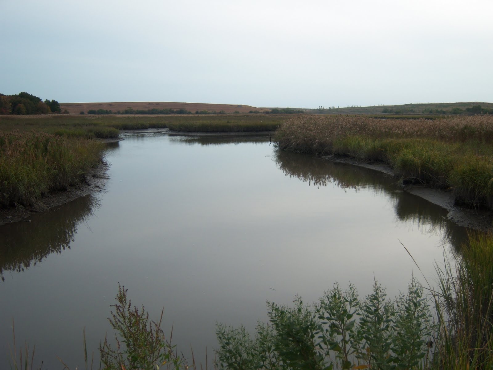
I'm actually going to try to get these last several bridges in pretty quickly here, so here goes. This bridge actually falls under the category of "don't even bother." The Travis Ave. Bridge on Staten Island in the Travis neighborhood sits on Travis Ave. (naturally) and crosses the Fresh Kills Main Creek. It sits about a quarter of a mile east of Victory Boulevard on a stretch of road about a mile long on the way to Richmond Ave. that has no sidewalk, no shoulder and no respect for the speed limit. Not good for running. The bridge itself is a standard steel and concrete bridge, not very long, not very interesting.


The road runs down the middle of parkland and a wildlife refuge, off-limits to human visitors, and it doesn't connect to anything or go on the way to anywhere of interest to runners, except to bridge freaks like me. It is actually not far from the Staten Island Mall, and not far from the site of the future Fresh Kills Park, but there are better ways to get to either location than this road. The wetlands and creek areas around here are nice, but there are better places to go to get a glimpse of them.


Travis, the town, was named after Colonel Jacob Travis, an early resident of the area. The neighborhood is one of the city's more sparsely populated, and has a somewhat small-town feel to it.

Wednesday, October 12, 2011

Bridge of the Week #69: Town Bridge


This week's bridge is one of the little gems that is often overlooked, that has the distinction of being not only the oldest existing bridge in the city (I believe, but most certainly in my survey), but is also the shortest: the Town Bridge.


This is a small stone arch bridge built in 1845 (as you can tell from the sign in the picture above), and it carries Arthur Kill Road over the Richmond Creek in the area of Historic Richmond Town on Staten Island, just north of the intersection of Arthur Kill Road and Richmond Road before Arthur Kill Road becomes Richmond Hill Road. (Yes, keeping all the "Richmond" places straight on Staten Island, aka Richmond County, is no small task.) Just from observation, the bridge looks to be about 10 feet long. But it is wide enough to carry a two-lane road, although with no sidewalks. Many of the streets in this area have no sidewalks, shoulders or room for runners or pedestrians other than on the far edge of the traffic lane.


Historic Richmond Town is one of Staten Island's most significant historic and tourist sites. It includes buildings that date back to the 17th century, and it has many special events. Just on the north side of the creek is St. Andrew's Church with a churchyard/graveyard that looks like it's straight out of a haunted house movie (no offense to those resting there). The streets here are not runner-friendly, as is the case on most of the island, unfortunately, but in this area, near St. Andrew's Church, you can connect to the miles of trails in the Staten Island Greenbelt. These trails can take you to near the Staten Island Mall, to Willowbrook Park, or even all the way to Clove Lake Park. I admit that I haven't explored these trails much at all, but they are another one of Staten Island's great resources, I believe.

Saturday, October 1, 2011

Bridge of the Week Bonus: Manhattan Valley Viaduct


This is a bonus entry, since it isn't a bridge by the terms I've set out for myself, but a viaduct. In other words, it doesn't go over a body of water but connects two hills on either side of what is known as Manhattan Valley roughly at 125th St. I decided to do a report on this viaduct since it's a good size and significant, and it's got aesthetic value, particularly from underneath, and it's a good place to run.


The viaduct itself carries Riverside Drive across the Manhattan Valley from just north of 122 St. at the General Grant National Memorial (Grant's Tomb) to 135 St. It has four wide lanes of traffic as well as parking lanes and sidewalks on both sides. There's plenty of room to run or walk, as it does have a lot of pedestrian traffic, and the roadway even has plenty of room for cyclists, even without bike lanes. But it should be noted that the sidwalks are almost never cleared of snow in the winter. The viaduct is good for runners, as you can run along the west sidewalk of Riverside Drive, usually alongside Riverside Park, without having to cross any streets between 95 St. and just north of 165 St.


Directly underneath the viaduct is 12th Ave, from St. Clair Place to 135 St. 12th Ave. itself is a horrible place to run, since there's a lot of traffic, and the sidewalks are taken up by forklifts and the bike lane usually taken up by delivery trucks for Fairway grocery store. Fortunately, last year Harlem Piers Park opened a block to the west, right along the river, connecting the Cherry Walk to the south with a dedicated bike lane and sidewalk leading to Fort Washington Park to the north. This enables a runner to run traffic-free directly along the river from the midtown piers to Dyckman St. That option doesn't involve running on the viaduct, but it's good that runners have those options.


Prior to the viaduct, Riverside Drive ran only from 72 St. to the loop around the current location of Grant's Tomb (completed 1897) and Claremont Dolphin Playground, the northern tip of which is as far north as nearby Tiemann Place (then 127 St.). Where the playground is now, there used to be located the Claremont Inn, a hotel with some big names among its customers. An eastern branch of Riverside Drive also continued, as it still does, downhill from about a block north of 122 St. down to St. Clair Place. In 1897 a bond issue passed to permit the continuation of Riverside Drive north to 157 St. and connect to Boulevard Lafayette (which would be renamed Riverside Drive as well). This extension would require construction of the viaduct, which was completed in 1900. The city council wanted to pass the bond issue in 1897 before the 1898 consolidation with the other boroughs into Greater New York, since the other boroughs had more debt and the bond issue might not have passed after consolidation. The history and development of Riverside Drive/Boulevard Lafayette/Henry Hudson Parkway is fascinating, and may be the subject of another post after I'm done with my bridges.


Pictures: 1. Underneath the viaduct, looking south along 12th Ave. from 135 St.; 2. Looking north on the west side of the viaduct; 3. Looking north from Claremont Dolphon Playground.

Wednesday, September 21, 2011

Race Report: North Coast 24 Hour Endurance Run


Satuday, September 17 saw the start of the 3rd annual North Coast 24 Hour Endurance Run in Cleveland, which for the third year hosted the USATF 24 hour national championship. It's a very well-done event put on by Race Director Dan Horvath and his mighty team of volunteers, aid station workers, the medical team once again headed by Dr. Andy Lovy, and the timing system this year by Rick McNulty of the New Jersey Trail Series.


The excellent organization of the race, the near-perfect course of 0.90075 miles, and the weather which has been excellent each year here so far all helped to sell out the 200 available spots and to draw many of the best and potentially best 24-hour runners in the country and beyond. The top two male and female finishers would also be guaranteed an invitation to run for the U.S. 24 hour team at the 2012 World Championships in Poland in September (provided they meet minimum mileage requirements, which would prove to be the case).


For myself, I had high hopes for a good race. After a very big spring, I had a disastrous 24-hour race in Philadelphia in July, and I was really hoping for a big race which I hoped might include some of the following: a spot on the team to Poland; a win and a second national championship (having won in 2009); beating my PR of 154 miles set way back in 2007; beating the masters record of just under 158 miles set by John Geesler (I'd hate to do that to John again - almost); a milestone of 160 miles; and I was also holding out hope for the remote possibility of beating Scott Jurek's American Record of 165.67 miles. But I was feeeling in good shape physically and mentally, and I was ready to get to work.


I flew to Cleveland, landing at midday, made my way to the Days Inn in Lakewood and waited for Byron Lane, who I would room with, to arrive. Ultrarunners in the New York area don't need to be told about the history of Byron and me, but suffice it to say we've gone head-to-head many times and had many close races and in the process have become good friends. We'd roomed together at the national championships in 2008 (in McKinney, TX) when Byron won the title and 2009 (Cleveland) when I won, so I guess this was a good sign. We had a pre-race dinner at Players restaurant, which Deb Horn had arranged, getting a ride with Jackie Choi and Jackie Ong, and meeting a lot of the other runners, and sitting across the table from Howard Nippert, the USATF rep, it was nice to get a chance to chat with him for a while.


Jackie, Byron, Kino and I arrived at the race about an hour before the start and began setting up. Byron and I shared a two-canopy complex in Tent City with Deb Horn, Mike Henze, Roy Pirrung and John Geesler. The race was full with the top runners, besides the above, including last year's winners Serge Arbona and Connie Gardner, previous record holder Mark Godale, Zack Gingerich, Jamie Donaldson, Anna Piskorska, Lisa Bliss, and many other excellent runners with a lot of potential. Looking down the entrant list, I was thinking there could be 50 runners over 100 miles and possibly as many as 10 over 140!


I'd been asked about my chances of winning or how many miles I thought I'd run. They have to know I'd never answer those questions! At least not before the race. I honestly wasn't worrying about winning, since I can't worry too much about competition until late in the race. I did set as my mileage goal a very ambitious 160 miles, and I mapped out my race and pacing chart accordingly. It was ambitious, but possible I thought, and what better time to try, with good weather and good physical condition? I'd actually shot for this a few times before, and at least I knew if it wasn't going to happen I'd be able to back off before I killed myself, and still have a good total.


So my goal meant starting out at about 7:00 per lap, or about 7:45 per mile, which I had actually done the previous years also. Throughout the race I'd keep track of my pace by my lap splits, or actually by my 8-lap splits. This is partly for the practical reason that my watch can only count up to 30 laps, and also by grouping the laps like this it makes the race seem more manageable. By the end of the first lap I found myself in the lead with Zack Gingerich, and we were chatting a bit. The laps went by mostly uneventfully. There was a fairly decent breeze from the east, which was then at our backs heading back to the start, causing a noticeable temperature difference on the different parts of the course. But I was able to stay on the pace I had set for myself longer than in previous years, so I was feeling very optimistic at this point. And I was still in the lead, although Mark Godale was closing in on me, only a lap behind as we neared the middle of the race. But it was still too early to worry about competition, I just wanted to stay on my own pace. After a few hours with Mark a lap behind me and waiting for him to pass me by, I eventually saw him stretch out on the grass, and later do some walking, so it looked like he was slowing down. But I will say that even when he was close behind me, his sizeable and enthusiastic crew team would cheer for me as I went by, so a big thank you to them!


I hit 50 miles (56 laps) in a swift 6:43, and was still feeling really good. After darkness came I slowed down more than I would have liked, I think partly because portions of the course were pretty dimly lit and I wasn't totally sure of my footing, especially at one spot where there's a little bump. It was nothing in daylight, but at night I kept hitting it wrong, throwing me off my stride and causing cursing every time! Many runners had headlamps, and even though I'd run this race twice before with no problem, and even though I hate wearing one, a headlamp might have been a good idea. Still, I hit the 100 mile mark (112 laps) in 14:38, which I think is my best 100-mile performance ever (my Brive split might have been faster but I'm not sure of that split). And actually it's probably more like 14:30, since we reach exactly 100 miles very soon after 111 laps. By this time I had I think five laps on Mark and about nine on the other men's leaders, who included German runner Kai Horschig and Jonathan Savage, who I'd chatted with briefly early in the race, and I knew had had a good 24 previously but I didn't know what he might be capable of. Serge and his friend Christian Creutzer were in the top five earlier, but were falling back a bit by this time.


On the women's side, the race had been led at times by Anna Piskorska, Jamie Donaldson and Connie Gardner, but now it looked like Connie had a good grip on her race, and was not too far behind me. Deb Horn was still moving very steady as always, and Lisa Bliss was moving up the leader chart.


In the later hours of the race, I'd adjusted my goals. 160 miles was not going to happen, and neither was the masters record of 158 miles. Beating my PR was still a possibility, but with my achilles starting to feel the strain, I would be happy just to keep moving and get the win, and 150 miles if I stayed steady. Meanwhile, I was enjoying the company of the other runners. Even though I don't talk much during a race, especially as the race goes on, I received a lot of encouragement during those nighttime hours, and I tried to give encouragement back as much as I was able. A special mention to David Corfman and Tammy Massie who gave nice words every time I saw them, and to Bonnie Busch, who encouraged me during my multiple breakdowns last year and who was still encouraging now when I wasn't suffering as much. Kino was great to watch with his patriotic outlook and his bursts of energy during the night, and Jackie Choi looked great in her fedora.


In the end I finished first with 153.37 miles, just a mile short of a PR, but a total I'm very happy with. Jonathan Savage finished strong and came away with a second place and over 146 miles, qualifying for next year's team also. Kai Horschig finished a close third with 145.5 miles, but is not a USATF member and can't run on the U.S. team. Harvey Lewis finished third with 140 and Byron finished fifth with 133 miles, a PR for him by quite a bit, which I was very happy to see! Connie won the women's race, and came just a mile short of Sue Ellen Trapp's American record, finishing fourth overall with 144 miles. That's her third time over 140 miles that comes to my mind, it's possible she's done more. Deb stayed strong for second place with a new PR of 131 miles! She's come very close to the 130-mile mark a few times before, so I was very happy for her also! So she'll be joining us in Poland as well. Lisa ran an amazing race and got third with just short of 126, Laura Bleakley was fourth with 112 and Bonnie was fifth with 108.


One other trivia note, this was my third time over 150 miles in a 24-hour race, which I thought put me in good company with the likes of Roy Pirrung and John Geesler, but they told me they'd only gone over 150 twice, and I might actually be the first American to get 150 three times! I'll hace to look into that!


In any case, it was a great experience overall, I made a lot more new friends, and a lot of people had great experiences as well. Five runners broke 140, and 40 runners got over 100 miles! My thanks to Dan Horvath, Joe Jurczyk, all the volunteers, aid station workers, trash picker-uppers, all the people who made the race work, and to Rick McNulty of the New Jersey Trail Series for working and monitoring the timing station the entire race. And thanks to Deb for the use of her table, Chris for her help during the race, Jackie for the ride to the race, Lisa for the ride to the airport, Byron for not snoring, and all the runners for creating such an amazing community that make it such a pleasure to run ultras.


Pictures: 1. Me at home with my trophy, t-shirt and one of the shoes that got me there (shoe company prefers to remain anonymous); 2. Connie and I after the race; 3. Current and former 48-hour record holders - me, John Geesler, Roy Pirrung, Ray Krolewicz; 4. Tamra Jones and Shannon McGinn; 5. Jackie Choi in her fedora

Monday, August 29, 2011

Bridge of the Week #68: Robert F. Kennedy Bridge


This is the biggest, badassest bridge of them all: the Robert F. Kennedy (RFK) Bridge. And yes, it makes my skin crawl to call it that, but that’s its official name now. For decades it was the Triborough Bridge but in 2008 it was renamed for that guy at the family’s request. For some reason, New Yorkers really seem to bend over backwards (or forwards) for that family. But that’s another story. On to the bridge.


The Triborough (from now on I will call it that) is definitely the biggest bridge in the city, mainly because it is three bridges in one: one from Manhattan to Randall’s Island, one from Bronx to Randall’s Island and one from Queens to Wards Island, all connected by viaducts and overpasses (one of which actually used to be a fourth bridge over Little Hell Gate from Randall’s Island to Wards Island, but the two islands were joined by landfill in the 1930s, so now that section is just a viaduct – and with no pedestrian element.) The vehicles therefore don’t have to go down onto land on Wards or Randall’s Island (unless they take that exit). But for pedestrians and cyclists they are separate bridges and you have to go down to the ground between each leg, which is a nice thing because Wards Island and Randall’s Island include some nice parkland and are nice places to run in their own right.


BRONX-RANDALL’S ISLAND:
This leg crosses Bronx Kill, which is a quite narrow and shallow waterway, one that could probably be walked across without drowning, and which can support watercraft probably no larger than kayaks. The bulk of the distance of the span is actually across industrial areas in the Bronx. There are two entrances on the Bronx side, on the east and west side of the bridge at Cypress and 133 St. If coming from the west, note that Bruckner Blvd. sits where 133 St. would be, until it veers off to the north a couple blocks west of the bridge entrance, so your approach would be from Bruckner Blvd. The east entrance has a stairway and the west entrance has a switchback-type ramp system to get up to road level. The two walkways join just before descending onto Randall’s Island. The entrance on Randall’s Island is on the north side of the island just off the main road, between the baseball fields. It’s not hard to find.


The bridge is a steel truss bridge with a main span of 383 feet and a length anchorage to anchorage of 1,600 feet. It has a clearance of 55 feet above water. It carries four lanes of traffic in each direction. For motorized traffic, the bridge leads in the Bronx directly to the junction of the Major Deegan Expressway and the Bruckner Expressway.


MANHATTAN-RANDALL’S ISLAND:
Of the three bridges, this is the only drawbridge, a lift bridge. This also has sidewalks on both the north and south sides. The Manhattan entrances are at the northeast corner of 124 St. and 2nd Ave., and at the southeast corner of 126 St. and 2nd Ave. The Randall’s Island entrances are a little harder to find. They can both be reached from a north-south maintenance road between the main road on the north side of the island, west of the Bronx span, and the north fence of the golf driving range. Once you get to this maintenance road there are signs, but they are easy to overlook. The north entrance is on the east side of the road inside the covered section of the roadway under the bridge. The south entrance faces the fence on the north side of the golf driving range, a few yards north of the maintenance road.


The length of the main lift span is 310 feet, with an anchorage to anchorage length of 770 feet. When lowered, the bridge has a clearance of 55 feet, and when raised, 135 feet. It carries three lanes of traffic in each direction. Cars can get on the bridge in Manhattan on the streets at 125 St. and 2nd Ave. or from the FDR Drive on the south or the Harlem River Drive on the north.


QUEENS-WARDS ISLAND
This bridge is easily the largest and most impressive of the three. It’s also the one that is likely to bring out the acrophobe in you. In my opinion it’s actually the most intimidating of any bridge in the city, due I believe to the relatively low surrounding landscape (which also gives you an incredible view), the height of the sidewalk above the roadway, and the relatively low railing between the towers once the higher chain-link fence stops. Only the sidewalk on the north side is open for pedestrians. It seems that the south sidewalk hasn’t been open for quite a few years. As near as I can tell, the Queens approach was taken down in the early 2000’s and the Wards Island/Randall’s Island approach some time before that. For the open north walk, the entrance in Queens is at 27 St. and Hoyt Ave., and the Wards Island entrance is not hard to find, on the main north-south road near the entrance to the psychiatric center. You can take a ramp up the entire way or use a staircase which meets the ramp partway up a little to the south. Until a few years ago, the walkway followed the roadway quite a ways farther along and descended to Randall’s Island north of the parking facilities. The beginning of that entrance is still there, closed off, but most of that unused walkway has been taken down. The new entrance is nice because it’s much closer to the ballfields on Wards Island, and the roads around them which provide some nice running.


The main span of this suspension bridge is 1,380 feet, with an anchorage to anchorage length of 2,780 feet. The clearance above water at the center of the span is 143 feet. The towers are 315 feet tall. The roadway carries four lanes of traffic in each direction, connecting in Queens to the Grand Central Parkway and the Brooklyn-Queens Expressway.


HISTORY
The idea bridge connecting Manhattan, the Bronx and Queens had been floating around for quite some time, to relieve congestion on the Queensboro Bridge, which was at the time the best way to get from the Bronx, upstate or New England to Queens or Long Island by car (this was long before the Bronx-Whitestone and Throg's Neck Bridges), until finally a concrete (so to speak) plan was proposed by Edward A. Byrne, chief engineer of the New York City Department of Plant and Structures in 1916. The city authorized funding for surveys, test borings and structural plans in 1925. Ground was broken by Mayor Jimmy Walker on Friday, October 25, 1929, one day after "Black Thursday." The five million dollars and change initially authorized was spent on condemnation of buildings, attorneys' fees and a few piers on Wards Island. In early 1930 the city appeared to abandon the project.


This is a good time to mention a few possibilities for the bridge that never happened. Engineer Gustav Lindenthal, designer of the beautiful Hell Gate Bridge, a railroad bridge from the Bronx across Randall's and Wards Islands and to Queens, didn't want a suspension bridge across Hell Gate close to his bridge to detract from its beauty. He proposed simply adding a second deck to his railroad bridge for motor vehicles, with spurs to Manhattan at 102 St. and 116 St. This proposal was not accepted, although the Queens suspension span plan was moved further south to give a little more distance from the Hell Gate Bridge. People today are so familiar with the bridge as it is, that they might not realize the clear logic of placing the Manhattan leg at 103 St., directly across from the Queens span and a mile closer to midtown. The 125 St. site was chosen because William Randolph Hearst owned property on 125 St., which would rise in value if the city needed it for a bridge approach. And Hearst had enough political power to call the shots, even after Robert Moses took over the project.


Speaking of whom, Robert Moses, New York City Parks Commissioner, New York State Parks Commissioner, Long Island Parks Commissioner, etc., etc., in 1932 convinced Governor Al Smith to resurrect the project, because he very much wanted the bridge to bring people out to his parkways and state parks on Long Island, including the immensely popular Jones Beach, as well as Caumsett and Sunken Meadows State Parks (had to give those two a mention) without driving through Manhattan streets. Moses himself drafted the state legislation to create the Triborough Bridge Authority, the "authority" being a relatively new concept of a joint public-private partnership, whose only significant precedent was the Port Authority of New York and New Jersey, which had built bridge and tunnel crossings between the two states. Mayor Fiorello LaGuardia appointed Moses commissioner of the authority. The Authority would be able to issue bonds and receive state and federal money for construction, in addition to approximately $37 million from New Deal programs, but it could operate under its own rules and wouldn't have to open its books. And importantly, Moses's legislative innovation was that the money from tolls that would normally go towards paying off the bonds and debts, at which time tolls would no longer be collected, could now be spent on other projects rather than paying off the bonds for the Triborough Bridge. This allowed Moses to amass huge sums of money which could be used to build projects like the Queens Midtown Tunnel, the Brooklyn-Battery Tunnel, the Bronx-Whitestone Bridge, the Throg's Neck Bridge, the Alexander Hamilton Bridge and the Verrazano-Narrows Bridge, as well as numerous parkways and expressways which he defined as bridge approaches. (The reader will note that none of the crossings mentioned in the last sentence have any access for pedestrians or rail lines.) The bottom line is that the Triborough Bridge was the foundation of Moses's amassing of power. His main office was even in the foundation of the bridge, in a building on Randall's Island underneath the toll plaza.


The bridge finally opened on July 11, 1936, at a cost of $60 million, greater than the cost of the Hoover Dam, and one of the largest public works projects of the Depression. To bring traffic to and from the bridge, the East River Drive in Manhattan (currently the FDR Drive), was extended north from 96th St., and eventually would come the Major Deegan Expressway and Bruckner Expressway in the Bronx and the Grand Central Parkway in Queens.


Soon after the bridge opened, it became clear that traffic congestion was not being relieved, but exacerbated. Rather than come up with any creative or innovative solutions, or improving mass transit, Moses and the Triborough Bridge and Tunnel Authority (after it took over construction of the Queens Midtown and Brooklyn-Battery Tunnels, the word "Tunnel" was added to its name) built more expressways and bridges, notably the Bronx-Whitestone Bridge and Throg's Neck Bridge, both of which passed directly from the Bronx into Queens, and neither of which relieved traffic congestion.


But that's traffic. For runners, the Triborough Bridge is a great resource, as a way to get to Randall's Island/Wards Island, to get from borough to borough, and the Queens suspension span is one of the great bridge crossings in the city.


Pictures: 1. The Bronx truss span over the Bronx Kill; 2. The Manhattan lift span over the East River; 3. The Queens suspension span over Hell Gate; 4. The pedestrian entrance in Queens; 5. The view of Queens from the Queens span; 6. The Hell Gate Bridge as seen from the Queens span.